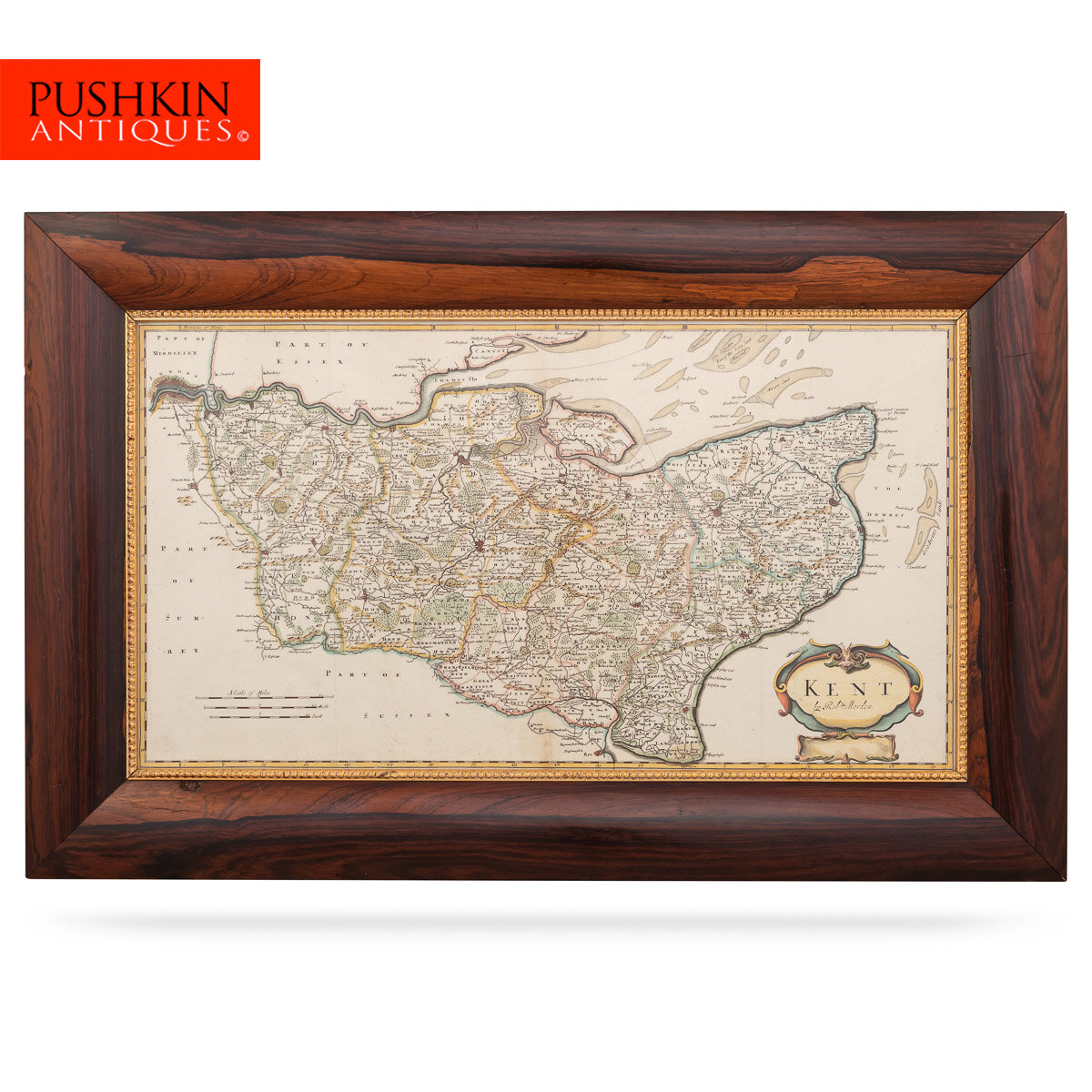


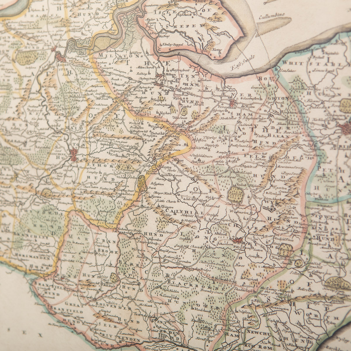


ANTIQUE 17thC ROBERT MORDEN MAP OF KENT c.1695
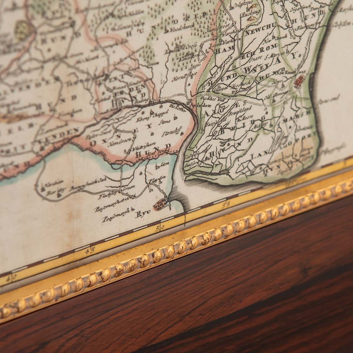
Antique 17th Century British very rare and original Robert Morden (1650-1703) map of Kent, publication 1695 or later, hand-coloured engraved map, map measuring 350mm x 630mm, mounted in gilt and solid wood frame with glazed front. Robert Morden was a leading English mapmaker from the last quarter of the eighteenth century.
Reference Number: A6619a
DESCRIPTION
Antique 17th Century British very rare and original Robert Morden (1650-1703) map of Kent, publication 1695 or later, hand-coloured engraved map, map measuring 350mm x 630mm, mounted in gilt and solid wood frame with glazed front. Robert Morden was a leading English mapmaker from the last quarter of the eighteenth century.
CONDITION
In Good Condition - Wear as expected with age and comes newly framed.
SIZE
Height: 52cm
Width: 81cm