


ANTIQUE 17thC JOHN SPEED MAP OF KENT WITH HER CITIES & EARLES DESCRIBED c.1676
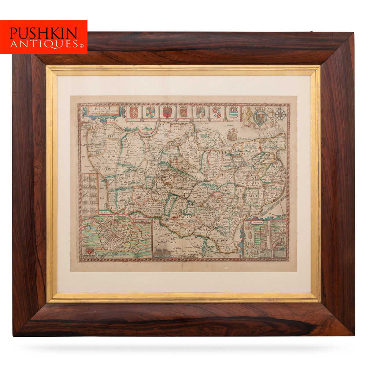
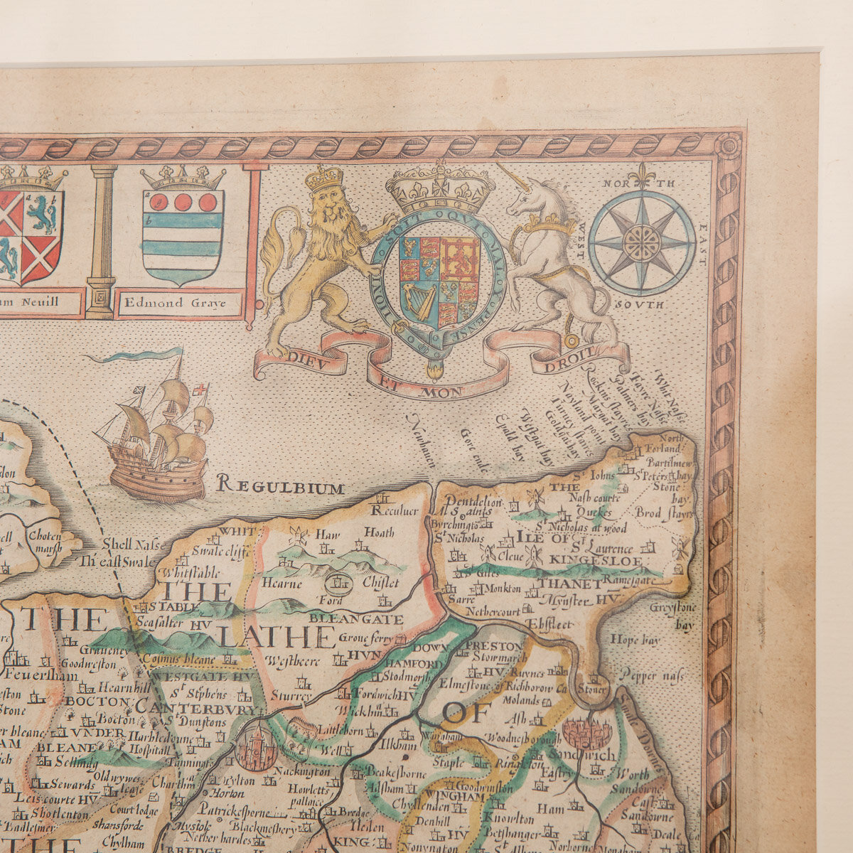
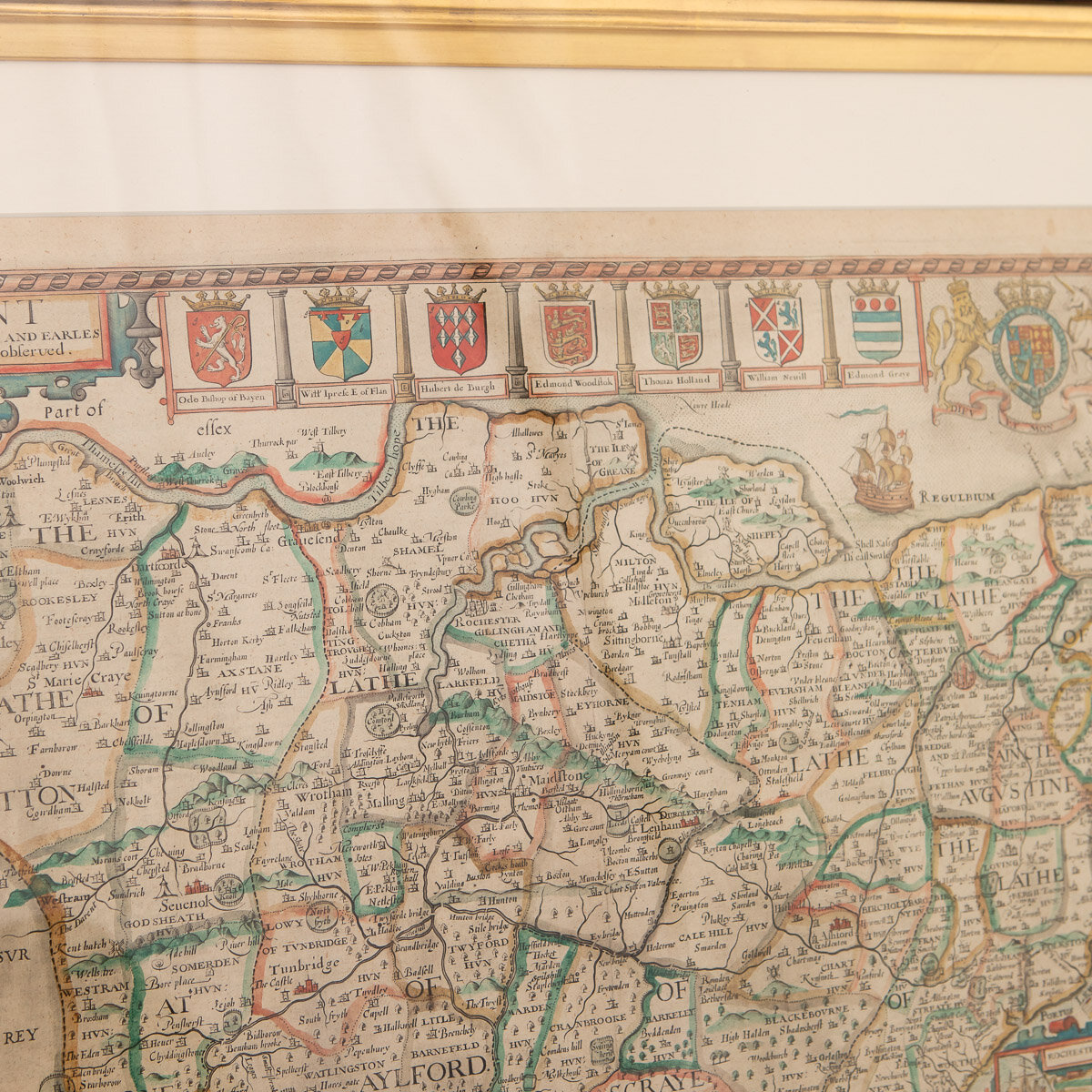
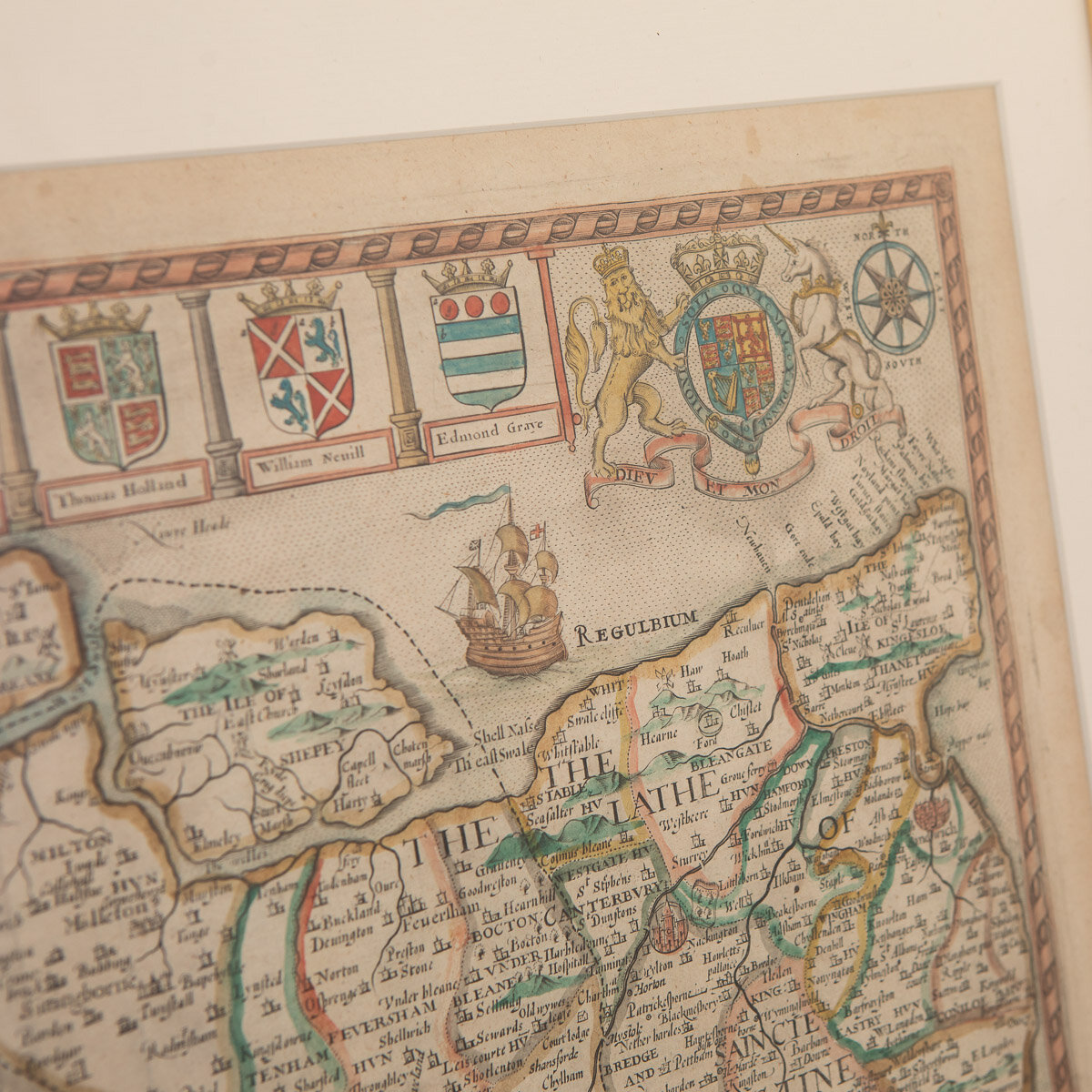
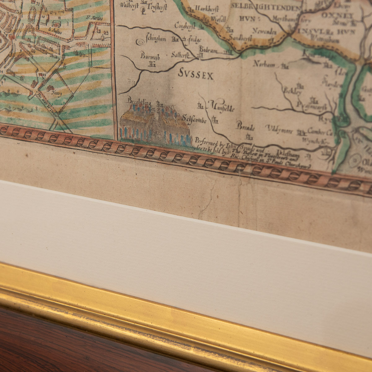
Antique 17th Century British very rare and original John Speed (1551-1629) map of Kent with her Cities and Earles described and observed, Thomas Bassett & Richard Chiswell, publication 1676, hand-coloured engraved map, map measuring 380mm x 505mm, English text on reverse, mounted in gilt and solid wood frame with glazed front. John Speed is undoubtedly the most famous single figure in the early history of the English map making.
Reference Number: A6620
DESCRIPTION
Antique 17th Century British very rare and original John Speed (1551-1629) map of Kent with her Cities and Earles described and observed, Thomas Bassett & Richard Chiswell, publication 1676, hand-coloured engraved map, map measuring 380mm x 505mm, English text on reverse, mounted in gilt and solid wood frame with glazed front. John Speed is undoubtedly the most famous single figure in the early history of the English map making.
CONDITION
In Good Condition - Wear as expected with age and comes newly framed.
SIZE
Height: 66cm
Width: 88cm


